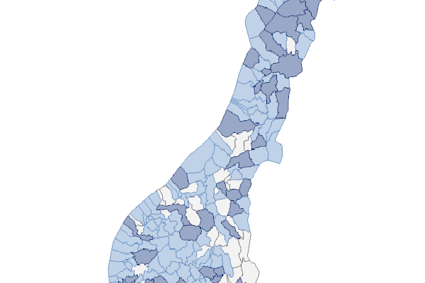
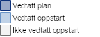
Tjenesten viser hvilke kommuner som har igangsatt og/eller gjennomført arbeidet med å utarbeide egne planer for friluftslivets ferdselsårer.
| Description |
Min scale |
Max scale |
GetLegendGraphic (WMS) |
|
Status per kommune.
|
|
Status per kommune.
|
|
|
|
Technical platform
ArcGIS Server
Technical platform
ArcGIS Server
Technical platform
ArcGIS Server
Server Url
https://kart2.miljodirektoratet.no/arcgis/services/friluftsliv_ferdselsareplan_dekning/MapServer/WMSServer

 NORSK
NORSK