|
Inngrepsfri natur/villmarksområder - status
|
|
Inngrepsfri natur/villmarksområder - status
|
|
|
|
|
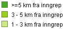
Inngrepsfri natur/ villmarksområder - status 1991
|
|
Inngrepsfri natur/ villmarksområder - status 1991
|
|
|

|
|
Status for 2016
|
|
Status for 2016
|
|
|

|
|
Status for 2022
|
|
Status for 2022
|
|
|

|
|
Inngrepsfri natur/ villmarksområder - status 2024
|
|
Inngrepsfri natur/ villmarksområder - status 2024
|
|
|
|
|
villmarksområder endring 1991 - 2016
|
|
villmarksområder endring 1991 - 2016
|
|
|

|
|
Endring fra 1991 til 2024
|
|
Endring fra 1991 til 2024
|
|
|

|
|
villmarksområder endring 2016 - 2022
|
|
villmarksområder endring 2016 - 2022
|
|
|

|
|
villmarksområder endring 2016 - 2024
|
|
villmarksområder endring 2016 - 2024
|
|
|
|
|
villmarksområder endring 2022 - 2024
|
|
villmarksområder endring 2022 - 2024
|
|
|
|

 NORSK
NORSK